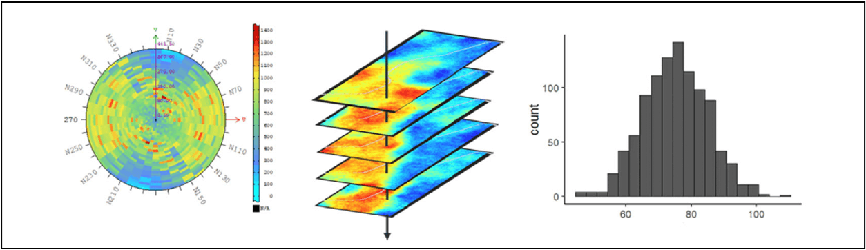
Geostatistical simulation quantifies spatial uncertainty, aiding interpretation in mining and environment studies, offering various risk levels
Geostatistical simulation quantifies spatial uncertainty, aiding interpretation in mining and environment studies, offering various risk levels
Most interpretation of project geology is deterministic in that a geologist or Engineer makes a determination of a single interpretation of the model. There is no measure for how good this is or how coloured this might be by their own practical experience. As such it is difficult to rigorously defend against any other expert opinion. Geostatistical simulation provides a means for truly quantifying the uncertainty spatially in the interpretation. For example, the uncertainty around the location of lithological boundaries, or the presence of lenses and boulders. It tells you what it is possible to interpret from the data set and the confidence in all possible interpretations while offering a best estimate. You decide the level of risk you want to take. It is used widely in mining and environmental contamination studies and the process is normally as follows:
Auditing and checking borehole logs and other ground investigation (GI) data in your project is time consuming. It can also be challenging to identify potential outliers or anomalies that require further investigation. Utilizing spatial trends present in the subsurface properties, geostatistical methods are employed to perform a detailed review of the GI data and check for potential outliers or anomalies that may exist. Furthermore, we can provide independent review of the 2D and 3D geological models for the project.
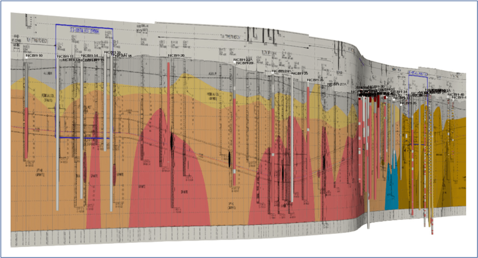

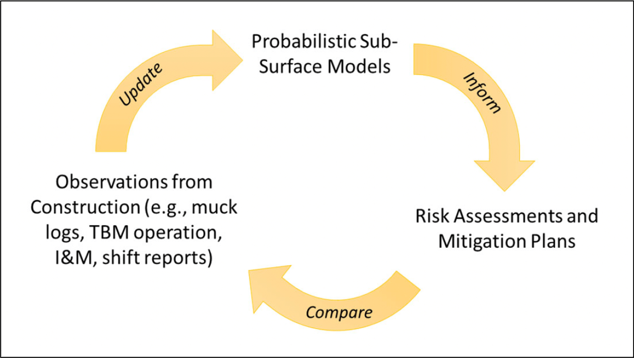
Owners, Designers and Contractors alike are often forced to rely on one single deterministic interpretation of the subsurface geology. The uncertainty in the interpretation is seldom quantified in a meaningful manner and leads to misguided confidence in the model.
The 2D and 3D geological models never provide the entire information of the ground properties and how it will influence construction. Understanding the spatial variability and uncertainty in geotechnical parameters provides significant advantages to all parties of the project. Geostatistical methods can be employed to develop 3D models of geotechnical parameters. The models can then be translated to specific risks and construction means and methods. These models take the form of 3D grids which can be extracted for analytical and numerical analyses.
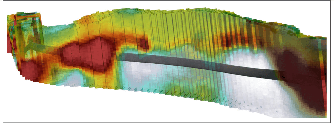
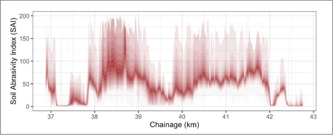
We provide know-how and experience to assist you with translating the geological-geotechnical model to a 3D risk model. With this model, we can quantify specific risks spatially over the project extent. This leads to improved risk assessments and mitigation planning. Examples of risk assessments these models can be applied to include: Likelihood for different site conditions, Clogging potential, Cutter tool wear, Groundwater issues and Ground movements.
Historical data near and around the project site is obviously invaluable to the current project – this includes both GI data and construction data from past projects. However, this data is not always clean and easy to integrate with the current project data. After careful auditing and analysis of the historical data to ensure accuracy, it can be used to improve confidence in the subsurface models and risk assessments.
Unfortunately, we find that only a single model of the subsurface geology is often used throughout the entire project, and this remains true even after additional data is collected during construction. This new data can be in the form of direct data about the subsurface conditions via boreholes, face maps and muck logs, and indirect data in the form of TBM operating parameters, probing records, geotechnical instrumentation data, interventions and shift report activities. All of this new information can be used to continuously update the subsurface models during construction, and improve the understanding of the true ground conditions. Furthermore, this data can be used to improve/update predictions of ground conditions to be encountered – resulting in better construction performance.
Geostatistics is a class of applied statistics used to analyze the spatial relationship of data in order to make predictions at unsampled locations. It is considered the best approach to model the spatial distribution and variability of geological and geotechnical properties. It provides a framework to integrate data from many sources (e.g., geological interpretation, direct measurements and secondary measurements/information. The method is practical (consistent with the data), repeatable and can easily be updated as additional information is obtained.
Dr Angus Maxwell: PhD in Rock Mechanics and Tectonics. Founder of Maxwell Geosystems and has been promoting geostatistical evaluations for ground engineering since 1992.
Dr Jacob Grasmick: North America Technical Lead with PhD from Colorado School of Mines in Subsurface ground characterisation using geostatistics.
Dr Rohan Walker: Canada Technical Lead with PhD in soft ground geotechnical engineering.
Connect directly with a Maxwell GeoSystems support expert via email, or live chat.
Gain access to MGS Learn, the online learning platform for free, self-paced courses on product and topic-based certifications.
Discover all the latest product information on MissionOS and share your experiences with other system users.